Land and Sea-Level Change
.")
Key messages:
- Impacts are dependent on relative land level change including subsidence and sea-level rise
- Land subsidence is highly variable, dependent on tectonics, compaction and human activity
- Even if temperatures stabilise, sea levels will continue to rise
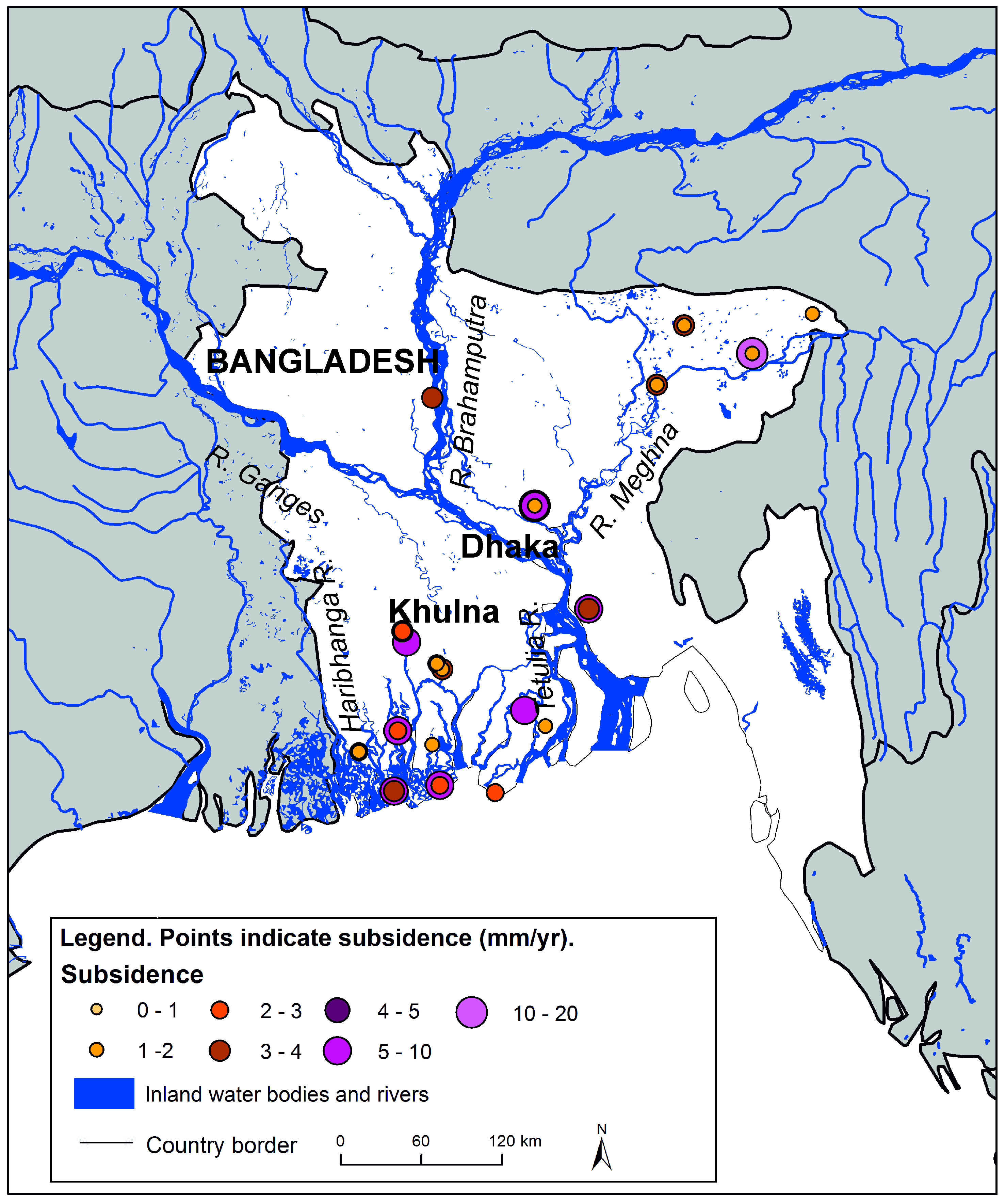
Why is the content of this map important?
Much focus is given to the effects of sea level rise in Bangladesh, but local land level changes can be equally important. Subsidence in Bangladesh is poorly documented and quantified, and can be very localised. The mean rate in Bangladesh is 5 mm/yr with a standard deviation of 4 mm/yr. Large rates are measured in cities, most probably due to human influences, e.g. water extraction. Active sedimentation occurs in some parts of the delta.
Which sectors are affected by this result?
The map is helpful for geologists, geographers, engineers, plus policy makers who are analysing rates of subsidence. The numbers behind the map indicate well-documented scientific measurements to allow high certainty into the rates and causes of land-level change.
What is shown on the maps?
The map illustrates subsidence in the Ganges-Brahmaputra-Meghna delta. All known rates of subsidence in the delta are listed in Brown and Nicholls (2015). Many subsidence rates in the published literature are unclear in terms of the exact location and measurement methods. Thus, the map only illustrates measurements where confidence in the rate of subsidence is high.
Details and further information:
 Global mean sea-level rise plotted against global mean surface temperature rise for two climate models.
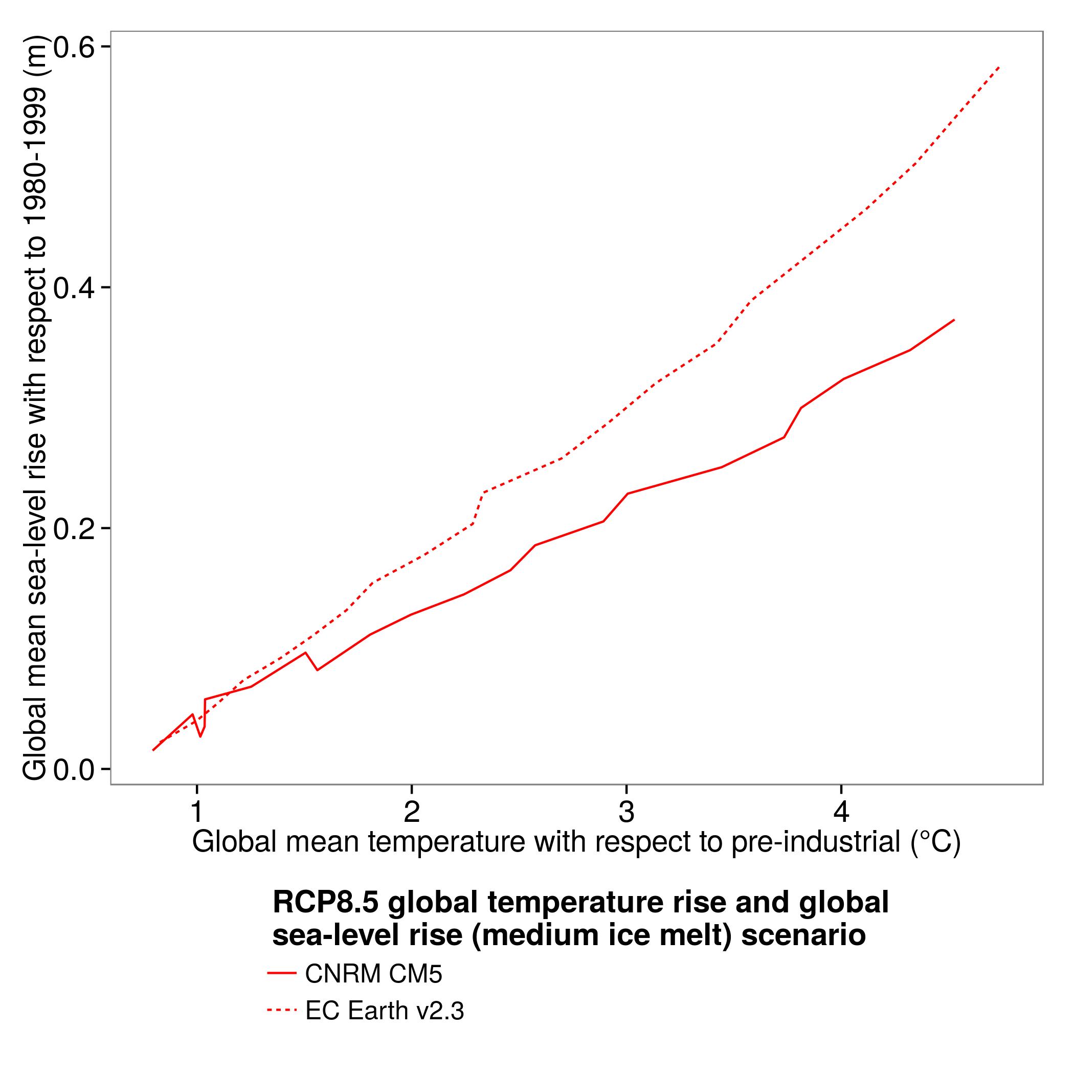
Relative land level change is also affected by sea-level rise. Oceans take time to absorb atmospheric warming so there is a time-lag between temperature rise and subsequent sea level rise. This is known as the commitment to sea level rise. Using an RCP8.5 scenario, temperature rise could reach 3.8°C and 4.2°C by the 2080s, leading to a sea level rise of 0.30 m and 0.49 m (based on the CNRM CM5 and EC Earth v2.3 models respectively). Greater rises are possible, particularly if ice sheets melt at higher rates than presently projected.
Additional information
The sea-level rise projections are based on the simulations with the CNRM CM5 and EC Earth v2.3 global climate models.
For rates of subsidence, see:
Brown, S. and Nicholls, R.J. (2015) Subsidence and human influences in mega deltas: the case of the Ganges-Brahmaputra-Meghna. Science of The Total Environment, 362-374. (doi:10.1016/j.scitotenv.2015.04.124).
Author:
Sally Brown, Robert J Nicholls
University of Southampton (SOTON), United Kingdom
The UK Met Office generated the sea-level rise scenarios used to assess land level change in Bangladesh.